Previous Workshops


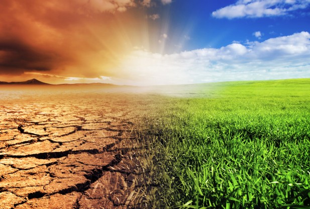
    Climate change

    Year 4 Grazing CAP Annual Meeting

    Beef produced on pasture and rangeland forages and dual-purpose winter wheat in the Southern Great Plains (SGP: Texas, Oklahoma and Kansas) provides a significant portion of the nation’s red meat; constitutes the largest land use and agricultural enterprise in the region; and is subject to a widely variable climate. The aim of the Resilience and vulnerability of beef cattle production in the Southern Great Plains under changing climate, land use and markets (Grazing CAP) project is to answer critically important research questions and deliver Extension program¬ming about impacts of climate variability and climate change on system vulnerability and resilience. Project long-term goals are to (1) better understand vulnerability and enhance resilience of SGP beef-grazing systems in a world of increased climate variability, dynamic land-use, and fluctuating markets and (2) safeguard regional production while mitigating the environmental footprint of agriculture. Specific objectives are to (1) build capacity among regional institutions to move research and extension to a higher level of integration; (2) better understand beef-grazing system dynamics, quantify vulnerability and resilience, and balance sustainability of production and ecosystem services; (3) provide information and technology to enable producers to employ risk-based information in decision-making; and (4) train the next generation of producers and researchers to collectively address rising challenges.
    Remote sensing

    2015 Oklahoma Workshop on Remote Sensing Applications

    Remote sensing technology of various platforms (in-situ, airborne and satellite) has made substantial progress over the past few decades and has been playing an increasingly important role in observation and monitoring of the Planet Earth. This one-day workshop aims to provide a platform for researchers and users in Oklahoma to communicate their research and application activities, discuss collaboration, and develop networks among researchers, users and students as well as institutions. Participants are also encouraged to take part in the Geospatial Information Science Day (GISday) Expo at the University of Oklahoma on November 17, 2015 (http://www.eomf.ou.edu/gisday/), where poster presentations will be held. Institutions are encouraged to register a booth at the GISday Expo event and showcase their research activities and/or needs in the area of remote sensing technology and applications.
    Climate change

    Year 3 Grazing CAP Annual Meeting

    Beef produced on pasture and rangeland forages and dual-purpose winter wheat in the Southern Great Plains (SGP: Texas, Oklahoma and Kansas) provides a significant portion of the nation’s red meat; constitutes the largest land use and agricultural enterprise in the region; and is subject to a widely variable climate. The aim of the Resilience and vulnerability of beef cattle production in the Southern Great Plains under changing climate, land use and markets (Grazing CAP) project is to answer critically important research questions and deliver Extension program¬ming about impacts of climate variability and climate change on system vulnerability and resilience. Project long-term goals are to (1) better understand vulnerability and enhance resilience of SGP beef-grazing systems in a world of increased climate variability, dynamic land-use, and fluctuating markets and (2) safeguard regional production while mitigating the environmental footprint of agriculture. Specific objectives are to (1) build capacity among regional institutions to move research and extension to a higher level of integration; (2) better understand beef-grazing system dynamics, quantify vulnerability and resilience, and balance sustainability of production and ecosystem services; (3) provide information and technology to enable producers to employ risk-based information in decision-making; and (4) train the next generation of producers and researchers to collectively address rising challenges.
    Remote sensing

    2014 Oklahoma Workshop on Remote Sensing Technology and Application

    Remote sensing technology at various platforms (in-situ, airborne and satellite) has made substantial progress over the past few decades and has been playing an increasing important role in observation and monitoring of the Planet Earth. This one-day workshop aims to provide a platform for researchers and users in Oklahoma to communicate their research and application activities, discuss collaboration, and develop networks among researchers, users and students as well as institutions. Participants are also welcome to participate in the Geospatial Information Science Day (GISday) at the University of Oklahoma on November 13, 2014 (http://www.eomf.ou.edu/gisday/). Institutions are encouraged to register a booth at the GISday Expo event and showcase their research activities and/or needs in the area of remote sensing technology and applications.
    Disease ecology

    The 5th International Workshop on Highly Pathogenic Influenza Risk Assessment and Risk Modling: Transitioning from Global to Local Assessments

    This workshop builds upon the 4 previous community-based data synthesis, analysis and modeling of Highly Pathogenic Avian Influenza workshops, which were coordinated by NIH, FAO and the University of Oklahoma; held in Bangkok, Thailand (2009), Beijing, China (2010, 2011), and Rome, Italy (2012). At the conclusion of the 4th workshop (November 2102) participants suggested that the broad scale, regional risk assessments and models developed to date may have limited applicability to national, provincial or local level issues related to influenza introduction, transmission and persistence. THe objective of the workshop to be held in May 2013 is to bring together multi-disciplinary international experts, national government representatives and experts, technical staff and other partners to explore disease risk factors at local levels. The desired outcome is to determine how influenza risk assessment and modeling should be pursued in order to capitalize on multi-disciplinary expertise and benefit national priority-setting for the prevention, response and control of HPAI.
    Disease ecology

    The 4th International Workshop on Community-based Data Synthesis, Analysis and Modeling of Highly Pathogenic Avian Influenza H5N1 in Asia

    This workshop builds upon the three previous community-based data synthesis, analysis and modeling of Highly Pathogenic Avian Influenza workshops, which were coordinated by NIH, FAO and University of Oklahoma since 2009. The focus of the workshop in November 2012 will bring together the experience and expertise arising from four different projects or initiatives, namely NIH, EPT+, CDC and FLURISK and it results from the interest shared by partners to better assess and model the potential risk of evolution and spread of pandemic influenza.
    Disease ecology

    The 3rd International Workshop on Community-based Data Synthesis, Analysis and Modeling of Highly Pathogenic Avian Influenza H5N1 in Asia

    The 3rd international workshop on “community-based data synthesis, analysis and modeling of Highly Pathogenic Avian Influenza (HPAI, H5N1 subtype) in Asia” will be held on November 14-15, 2011, Beijing, China. This 3rd workshop is a follow-up of the 2nd workshop (Beijing, China, May 31 – June 4, 2010) and the 1st workshop (Bangkok, Thailand, June 15-17, 2009). The overall objectives of this workshop series are twofold: (1) to identify and assemble available geospatial datasets relevant to HPAI (H5N1), and identify major gaps in data and models, which would assist prioritization of future research in data collection and models; and (2) to facilitate capacity building for a network of researchers and institutions, and infrastructure for data synthesis, analysis and modeling.
    Disease ecology

    The 2nd International Workshop on Community-based Data Synthesis, Analysis and Modeling of Highly Pathogenic Avian Influenza H5N1 in Asia

    The objectives of the planned two workshops are twofold: (1) identify and assemble available geospatial datasets relevant to HPAI (H5N1) spread, and identify any major gaps in knowledge and data, which would inform and allow prioritization of future research and data collection activities; (2) facilitate capacity building for a network of researchers and institutions, and infrastructure for data synthesis, analysis and modeling.